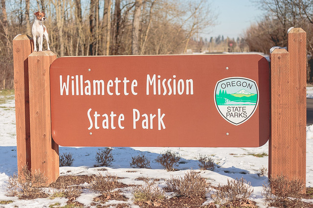
Early on this year we got hit with some snow. During that cold snap, I visited a few parks. Willamette Mission State Park is located near Keizer, OR and requires a state park pass to use. The park was flooded and the gates were closed, but we managed to spend about an hour hiking around some non-flooded trails in the crispy snow.
 |
| Snow on the ground in the Salem area despite the sun |
In this same cold snap, I visited Keizer Rapids Park, also in Keizer, OR along the Willamette River. It was near dark and I didn't have my camera, so I missed getting a good picture with the sign.
Our first beach trip of the year was a quick sunset trip to Gleneden Beach. Gleneden is between Lincoln City, OR and Newport, OR. Despite the cold weather further inland, the beach was warm, with very little wind. The waves were huge with an incoming storm front, which actually spelled the end of the cold snap in the valley.
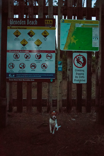 |
| The sun was already down, and tall trees blocked the remaining light, so super bad photo |
We are lucky in Oregon to have a ton of awesome beaches. I am most familiar with the ones near and around Newport, since that is what has always been easiest to get to. A friend of mine invited me along for an overnight trip to Yachats, OR, which is further south than I normally go, though I certainly have been that far before. The tide was super high, however, and the tide wasn't headed out until we had to be headed back to the valley. So instead of hitting the beach, we did some hiking on Cape Perpetua.
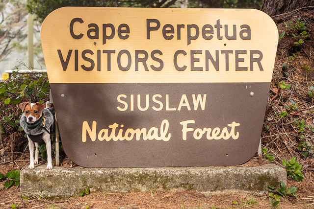 |
| Sign at the actual Visitor's Center |
Somewhat confusingly, Cape Perpetua has a visitor's center, but also a different day use area, and an info center, all of which are in different places along the highway. We were supposed to meet some friends at the visitor's center, but parked at the Devil's Churn Info Center instead. Luckily, there are trails that connect the two, so even though we were in the wrong place, we just headed down the trail and met our friends part way. Once we met up, we headed further south along the trail system to Thor's Well (which was almost completely under water due to the absurdly high tide) and the Spouting Horn, which was super impressive due to the high tide. Much conversation on this part of the hike covered how stupid people were to be climbing around on the rocks with super high surf and the tide coming in.
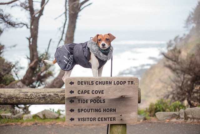 |
| The trail head at the Devil's Churn Info Center. The Devil's Churn is behind Ptera, and off to the right in the photo. |
The hotel we stayed in was great, except that it didn't actually access a beach, just some nasty rocky shoreline. A great little trail did run along the shore for a little ways, though that didn't fix the beach craving we were having. Of course, we still made good use of the trail a few times during our stay.
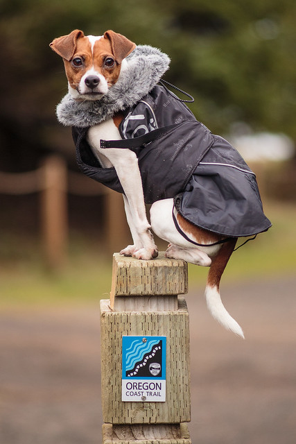 |
| Oregon Coast Trail marker on the trail outside the hotel |
Bald Hill Park Trail Complex is one of the places I hike the most often. It is a short drive away, and has a ton of really great trails. In many areas, dogs are allowed to be off leash as long as they are under voice control. I've hiked to the top of Bald Hill twice this month with different friends, and have hiked at the park I don't know how many times without going to the top as well.
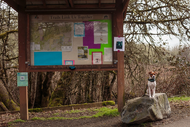 |
| Huge info sign about the three different trail systems that make up the Bald Hill Park Trail Complex |
For those of you who have been reading this blog for years, you may remember that Koira was bitten by a coyote. That bite happened on one of the trails at Bald Hill in the spring, likely because the coyote had pups in the woods nearby. While I still hike this area, and still let Ptera off leash here, I do pay attention to any warning signs posted and hike with caution in April/May when there are likely to be coyotes with young. Around here if you never hiked anywhere with coyotes, mountain lions, bobcats, lynx, etc, you would never get to hike.
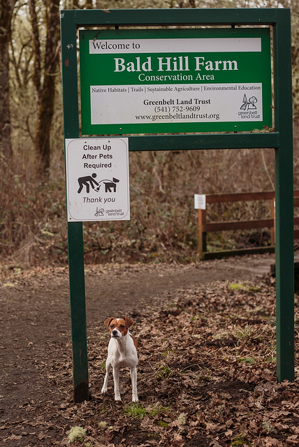 |
| Part of the trail system is maintained by the Greenbelt Land Trust |
I also tried out a trail I haven't done before, Fitton Green Natural Area. I can't really say why I haven't hiked this part of the trail before, except that it is unknown. This portion of the trail system was closed for a while this fall to build a new section connecting two existing trails, and it has been in the back of my mind ever since that I really should check out some different areas.
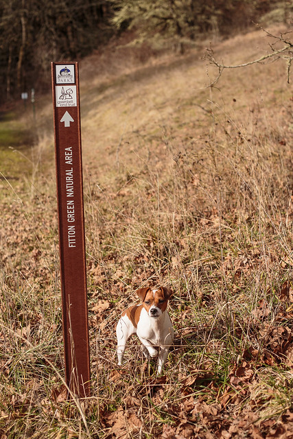 |
| Trail marker on the new trail |
So those are the beaches and trails we hit this month. What have you been doing outdoors this January?
This may be silly, but I love all the signs and trail markers!
ReplyDeleteI love trail markers and signs. I think it is fun to see all of them together like this.
DeleteLooks like you found some pawesome new places for going on adventures :) Milo & Jet
ReplyDeleteYou really covered a lot of territory in January! We didn't get too to many different parks--my puppy and I tried out a new trail we'd never been to and we went to the state park close to us a few times, but it has been so bitter cold and icy that walking any closer to Lake Erie than we do in our neighborhood just didn't seem appealing!
ReplyDelete